ArcGIS如何打开经纬度数据转成Shape

 时间:2024-10-29 13:10:29

1、打开ArcGIS ,并新建一个Map地图文档

ArcGIS如何打开经纬度数据转成Shape

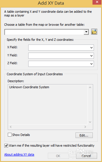
2、选择Add Data,然后选择添加X,Y数据

ArcGIS如何打开经纬度数据转成ShapeArcGIS如何打开经纬度数据转成ShapeArcGIS如何打开经纬度数据转成Shape

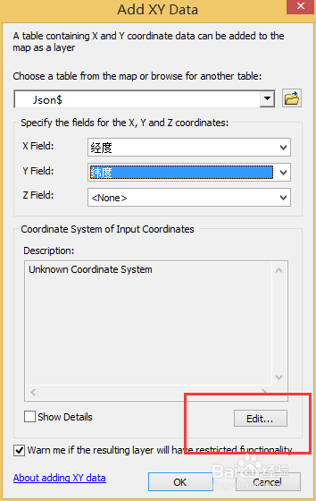
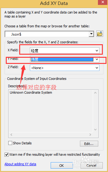
3、选择匹配的数据表字段和合适的地理坐标,我这里用的是WGS 84,打开后的数据如下
ArcGIS如何打开经纬度数据转成ShapeArcGIS如何打开经纬度数据转成ShapeArcGIS如何打开经纬度数据转成ShapeArcGIS如何打开经纬度数据转成Shape

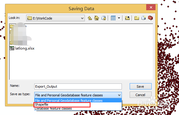
4、右击Export Data 单击选择路径和文件名,选择Shape 格式

ArcGIS如何打开经纬度数据转成ShapeArcGIS如何打开经纬度数据转成ShapeArcGIS如何打开经纬度数据转成Shape

5、生成完成后把Shape格式数据导入软件中 ,结果如下

ArcGIS如何打开经纬度数据转成ShapeArcGIS如何打开经纬度数据转成ShapeArcGIS如何打开经纬度数据转成Shape
  • 如何把cad图转换成arcgis?
  • arcgis软件arcmap中mdb如何转shp
  • 西安80坐标系(高斯投影)转经纬度111
  • AUTO CAD批量输入坐标的技巧
  • ArcMap怎么导出CAD(dwg)文件
  • 热门搜索
    什么是劳务派遣 曦是什么意思 搬新家送什么礼物好 psa是什么意思 魇是什么意思 什么是金融 sync是什么意思 fake是什么意思 bl是什么意思 arm是什么意思中文